
This mini-project turned out to be a great example of how tailored AI systems come to life. While the first goal was simply a tasty dinner, the real takeaway was the power and flexibility of the tech behind it. Similar perceptual systems could easily scale to autonomous machines in agriculture, construction, or defense. These systems could enable real-time ground analysis and assess stability or risk in milliseconds to ensure operational safety and efficiency.
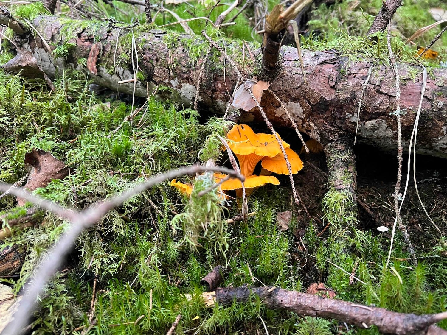
The idea was simple: build a tool that could learn where the good spots are while we’re walking.
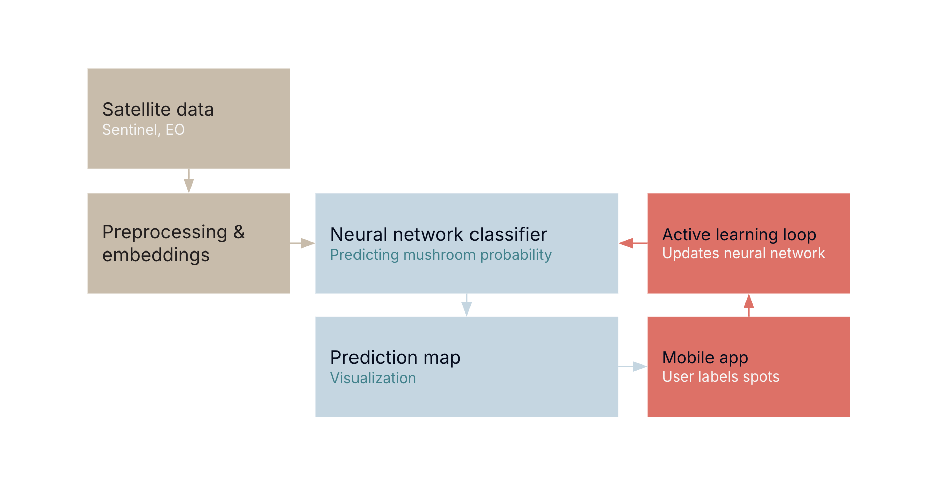
At the core were embeddings. They are feature representations created from publicly available Earth Observation data, mainly Sentinel satellite imagery. These embeddings capture a lot of detail about the forest environment (things like soil moisture, canopy density, and terrain structure) at a resolution of about 10×10 meters per grid cell. In short, they compress years of observations into a compact description of each location.
On top of the embeddings we trained a small neural network to predict the probability of finding mushrooms in any given 10×10 meter square.
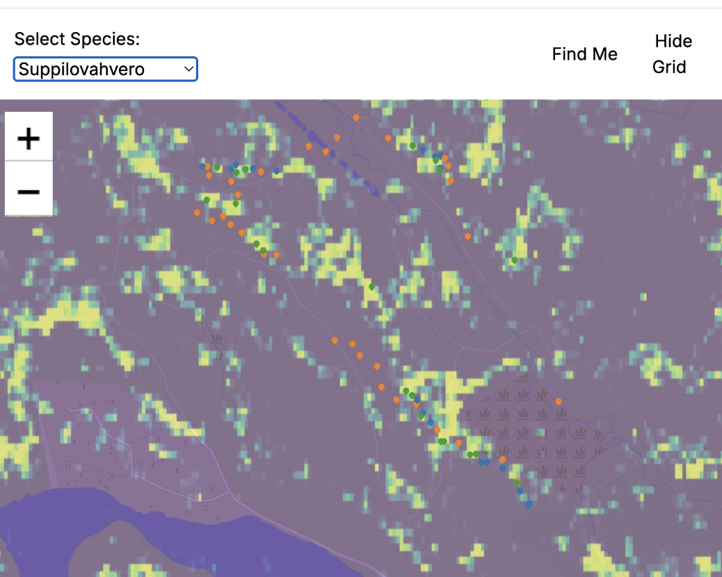
Then came the fun part — we added an active feedback loop. While hiking, every time we found a mushroom patch, we marked that grid cell as “positive.” If we explored an area that looked promising but turned out empty, we marked it as “negative.” We even logged a few different mushroom species. The model updated itself on the spot, constantly learning from new data. To make that possible, we built a simple web app we could use right from our phones.
There are already apps out there for mushroom hunting, but most rely on static rules, like biological data and historical sightings. Ours, on the other hand, learns dynamically. It figures out the conditions for growth as they change. Once you find your first patch, it helps guide you to the next one.
After completing these steps, we’d trained a model to classify terrain from satellite data just to find mushrooms, but the same input data and the same core capability can be repurposed for much more critical or industrial applications:
- Real-time traversability estimation: The same features that help locate mushrooms can tell if a forest area is swampy, dense, or uneven. That’s invaluable for machines in agriculture, forestry, and construction, helping them plan safe and efficient routes in real time.
- Defense and security: Terrain “walkability” is a key factor for operational planning and off-road movement.
- Environmental monitoring: These classifications can support forestry, conservation, and land management with high precision.
Our little mushroom seeker project proved that a high-resolution classification layer, trained quickly through active learning, can be incredibly effective. It’s a great example of how to build tailored AI – we take general models and technologies, combine them with high-quality, context-specific data, and produce a system that gives our clients a unique, practical advantage.
My biggest takeaway from that weekend? Sometimes, the smartest AI systems start with a simple human touch. A quick loop of feedback and labeling in the field turned a general satellite dataset into a focused, high-resolution solution.
Want to learn how Emblica can build a cutting-edge AI system for your needs, even if they’re as niche as mushroom foraging? Let’s talk.
Emblica is not your average data team. We build customized solutions for collecting, processing, and utilizing data for all sectors, especially at the R&D interface. Whether our target is a factory line, an online store or a field, you can find us busy at work, hands in the clay - at least at our office in Helsinki.